What comes next? - Disciplined Research
Our staff build technology and through examination of the current gaps, we envision what SHOULD be, then we build it. Our research is not just shaping technology today, we're building what comes next.
How do we get there? - Applied Engineering
Once we understand where we are and what is missing in the industry, we build it. Our applied engineering expertise across multiple languages, platforms and industries is our strength. We're not just scientists or engineers, we're practitioners who started in the trenches and plan for how the new technology will impact operations. Incremental delivery, organization change strategies for us they go hand-in-hand.
Why is it that way? - Challenge Current Approaches
Point to the horizon and start marching. We never just accept how things are currently done. We evaluate how things should be, clean-slate, start-from-scratch. Then we determine how far off the status-quo is from that ideal and map an incremental path to get there.
What can we achieve? - Everything is Achievable
Our march to the horizon is an ever changing course, constant improvement, continual learning. You can be part of our journey and help to shape the future, just ask us how.
Our Technologies
OSRS Group is working on several key areas, we divide our work into projects which roughly cover a technology area. Each project will have multiple sub-areas and applicability to many organizations and industries.
Our industry focus dimension is accounted for separately in our active area "P" (Industry Projects and Functional Domains), which contains sub-projects for each industry domain in which we are conducting work.
Top-level General Scope Technology R&D Ongoing Project Areas:
- Area A: Geospatial and Location Technologies
- Area B: Agent Based Simulation and Computational Modeling
- Area C: Math, Logic and Numerical Computing
- Area D: Enterprise Framework and Well-Known Types
- Area E: Temporal, BiTemporal, TimeSeries, History and Archival Systems
- Area O: Open Data and Specifications
- Area M: Machine Learning and Artificial Intelligence
- Area P: Industry Projects and Functional Domains
- Area S: Cybersecurity, Anti-Tamper, Information Assurance and Data Governance
- Area W: Commons Core Technologies
- Area X: Runtimes, Virtual Machines and Programming Languages
- Area Y: Operating Systems, Containers, Distributed Environments
- Area Z: Hardware, Hardware Anti-Tamper and Physical Security
Top-level Industry Projects and Functional Domains (Area P):
- Analytics: General Purpose Risk and Comparative Risk Ratings (GRAMI)
- Data: Administrative Boundaries, Measurement Sites, Geolocation of Well-Known and Casual Locations
- Data: Biological Taxonomies and History of Changes and Common Names
- Data: Census, LODES, Commerce
- Data: Climate, Weather and Atmospherics
- Data: Land use, Land cover, Terrain and Geodetic Movement
- Data: Manufacture of Goods and General Product Taxonomies
- Data: Measurement Instruments, Sensors, Calibrations and Manufacture
- Data: People, Organizations, Contactable Parties and Addressing Systems
- Data: Real Property, Structures, Parcels and Cadastre
- Infrastructure: Drinking, Treatment and Irrigation Water Distribution
- Infrastructure: Electric Power Grid
- Infrastructure: Oil, Gas and Pipeline
- Infrastructure: Telecommunications
- Infrastructure: Transportation: Roads and Rails
- Infrastructure: Transportation: Ships, Shipping, Maritime Routes and Ports
- Infrastructure: Transportation: Airports, Air Routes, Aircraft
- Infrastructure: Transportation: Dams, Bridges
OSRS Geospatial Capabilities. Robust, deep capabilities and ESRI/OGC Compatible.
We've built custom geometry libraries for vector geometries including upcoming support for global and polar spanning features. We have support for geospatial grids of multiple cell shapes including support for a semi-uniform global grid system. Our grid capability includes support for highly multi-threaded agent-based computation using image processing inspired algorithms. We also have a robust, dynamic tessellation engine that supports creation of constrained Delaunay triangulations with mesh quality guarantees. Finally, we support a geospatial binding to our agent-based simulation framework that supports complex, dynamic computation over vector and gridded datasets for complex analysis.
Temporal Computing. What was and when did we know.
We offer several temporal capabilities including a general purpose temporal library (in development) that handles temporal data from high-precision attosecond scale to massive "history of the universe" scale. Our primary temporal areas of interest are time series/time sequence capabilities for measurement data which we support across a host of persistent data stores, and our temporal/bitemporal capability for fully temporally enabling enterprise record data. This temporal capability is designed to support geospatial data with our custom extensions for spatial-temporal interpolation of events.
Enterprise SoSD Framework Model. Easy, compact, done.
Given we invented SoSD and Systematize, we of course have a suite of libraries for providing simplified development of autonomous services which can be dynamically scaled and provisioned. Our framework model offers a distributed system of systems security, logging and configuration capability as well to keep your enterprise data and analytics flowing.
Well-Known Data System. Consume, Share, Integrate, Done.
Building on our other capabilities, we've developed an approach to integrated, distributed services for well-known data types that are efficiently shared between applications, departments and organizations in real time. No development required, just deploy an existing package or contact us to help adapt to your needs and infrastructure.
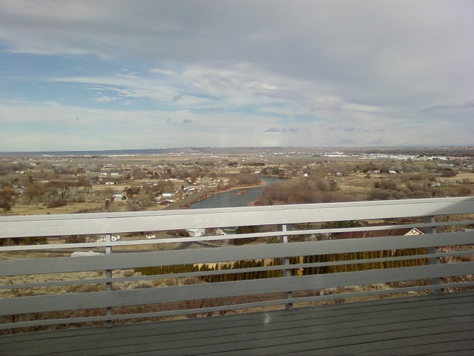
Infrastructure Analytics. Assess, Plan, Mitigate Risk.
Telecommunications, Energy, Transportation. Infrastructure is a critical resource and OSRS Group has been helping stakeholders understand and mitigate risks to critical infrastructure for over a decade. We build solutions that help decision makers and engineers understand where vulnerabilities are and more importantly, which impacts are most likely to better inform mitigation planning.